Earth and Enviornmental Science Porfolio Project
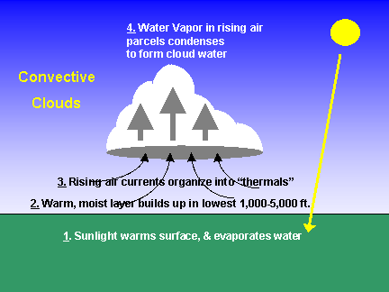
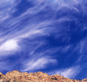
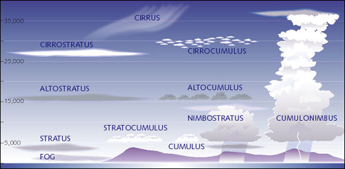
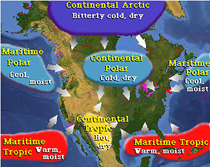
What Causes The WeatherThe sun heats the earth, as we all know. Weather processes such as wind, clouds, and precipitation are due to the atmosphere responding to uneven heating of the earth due to the sun. This uneven heating causes air currents or wind to develop. This then moves the heat to places with higher temperature and lower temperature. High pressure and low pressure areas, wind, clouds, and precipitation are all caused by the uneven heating from the sun. This results in the redistribution process. There are two types of redistribution, vertical and horizontal; vertical is caused by solar heating of the surface of the earth causes an unstable atmosphere, causing vertical air currents. Horizontal is caused by the way the sun shines on the spherical earth; this causes horizontal temperature which causes pressure differences. www.weatherquestions.com/What_causes_weather.htm Cloud Formation and Types- Clouds form when rising air through expantion cools to the point that some of the water molecules clump together than they were torn apart with their thermal energy. The water evaporates from the heat of the sun and rises and condences into clouds. Orographic Uplifting- This is where the flow of air is forced up over highlands and mountains. Moist air being forced begins to cool, concequently condensation forms and rain or snow begins to fall. http://www.geography-dictionary.org/OROGRAPHIC_LIFTING Convectional Uplifting- The vertical lifting of parcels of air through convective heating of the atmosphere. This process can initiate adiabatic processes inside the air parcel. http://geography.geography-dictionary.org/Convectional_Lifting Frontal Uplifting- Lifting of a warmer or less dense air mass by a colder or more dense air mass at a frontal transitional zone. http://geography.geography-dictionary.org/Physical-Geography-Dictionary/Frontal_Lifting Main 3 Types of Clouds- 1). Stratus- are uniform grayish clouds that often cover the entire sky,they resemble fog that does not reach the ground. Usually no precipitation falls from stratus clouds, but sometimes they may. When a thick fog "lifts," the resulting clouds are low stratus. 3). Cirrus Cloud- these are thin wispy clouds that form at 18,000 feet above. These clouds are blown by strong westerly winds and generally move from east to west. These clouds form when water vapor undergoes decomposition and forms ice crystals.
|
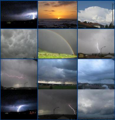
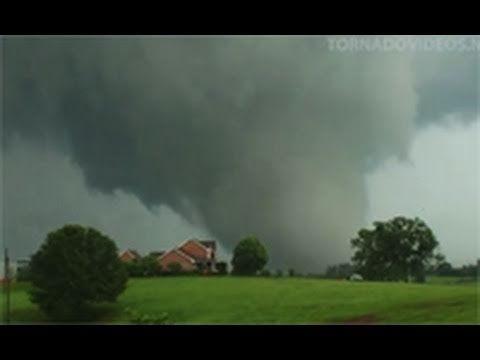
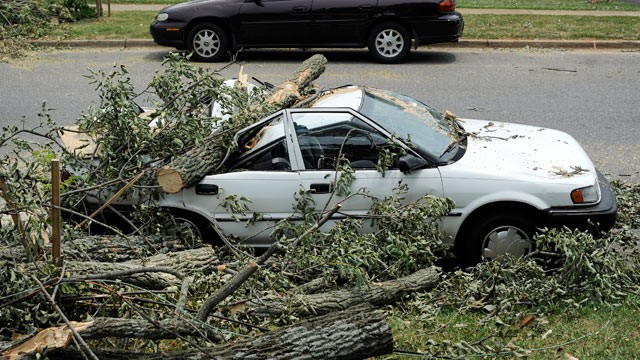
Types of Storm Systems1. Tornadoes- Tornadoes have high winds up to 300 miles an hour and cause a lot of damage to the area it hits. It is a type of cyclone and is funnel shaped. They also have very heavy rains and a lot of lightning. In April of 2011 there was a tornado outbreak of about 326.
|
 2). Cumulus Clouds- this cloud is a fair weather cloud and are usally seen at low altitudes. If there is enough insabability they can form into cumulonimbos cloud, which is a storm producing cloud.
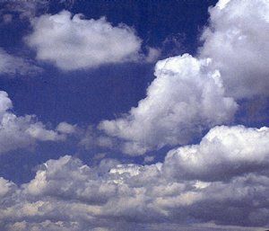


Philosophy